This 214-mile loop from Bisbee is the crown jewel of Southeast Arizona adventure riding, taking you from the high-desert grasslands into the towering “Sky Island” of the Chiricahua Mountains.
Leaving Bisbee, head east toward McNeal (your last reliable gas for a while) before turning onto Leslie Canyon Road. This is a fast, graded dirt road that winds through the Leslie Canyon National Wildlife Refuge, a riparian oasis where the desert floor gives way to lush greenery.
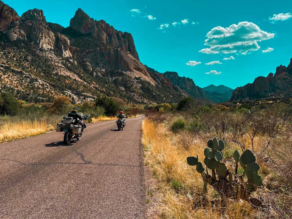
Continuing north, you’ll hit Rucker Canyon Road (FR 74), which leads into the heart of the southern Chiricahuas. Expect broad views of the mountains and occasional creek crossings that can be “moist” or muddy depending on recent winter rains.
From Rucker Canyon, the route skirts the eastern edge of the mountains, passing the Geronimo Surrender Monument before reaching the village of Portal. Known as the “Yosemite of Arizona,” the sheer rhyolite cliffs here are breathtaking. Stop at the Portal Cafe for a mid-ride refuel.
The road begins to climb steeply through Cave Creek Canyon, transitioning from desert scrub to dense ponderosa pine and fir forests. Onion Saddle is the high-elevation centerpiece of the ride. Crossing Onion Saddle, you descend the western slope via Pinery Canyon Road (FR 42), which connects directly to the Chiricahua National Monument.
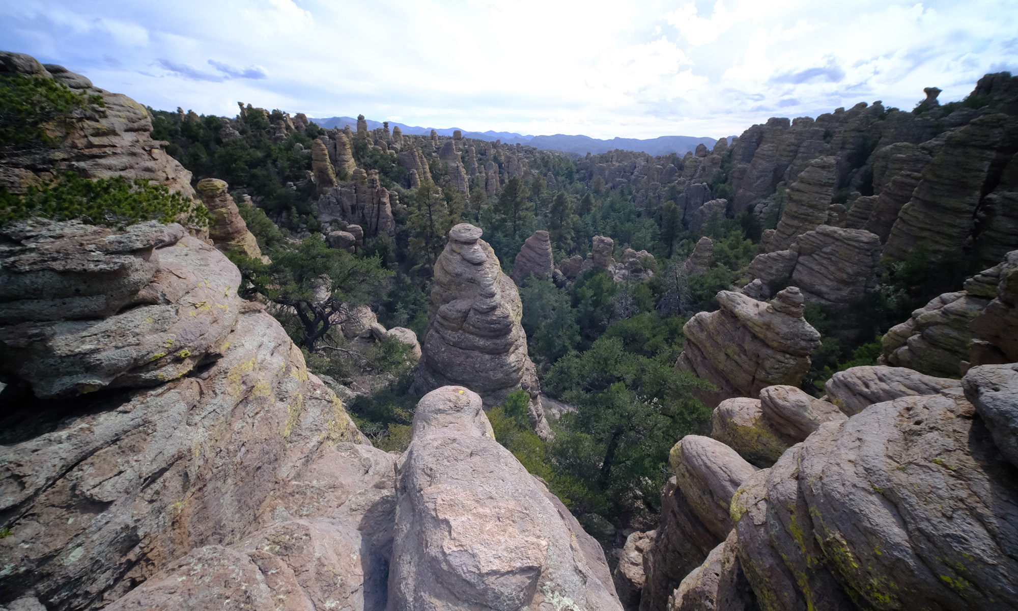
Enter via Bonita Canyon Drive to witness the “Wonderland of Rocks”—massive volcanic ash spires and balanced boulders. Ride all the way to Massai Point (6,870 ft) for a 360-degree view of the hoodoos before heading back down the pavement toward Sunizona and eventually home to Bisbee.
Details
- Location: Starts and ends at The Jonquil Motel in Bisbee, Arizona
- Distance: 214 mile loop
- Gas: Bisbee, McNeal, Sunizona, Elfrida
- Difficulty: Easy/Intermediate
- Road Surface: paved, gravel, loose rocks, steep hills, elevation gain
- Time: full-day
- Seasonal road closures on high elevation pass
- Connects to: High Lonesome
Approximate Mileage
- Start – Circle K Bisbee – 0 miles
- Gas – McNeil – 24 miles
- Start dirt – 25 miles
- Leslie Canyon Road – 37 miles
- Leslie Canyon National Wildlife Refuge
- Rucker Canyon Road – 53 miles
- End dirt – 72 miles
- Geronimo Surrender Monument – 82 miles
- Rodeo, NM – 93 miles
- Chiricahua Desert Museum – 96 miles
- Sky Islands Grill & Grocery – 96 miles
- Portal, AZ – 102 miles
- Portal Store Cafe & Lodge – 103 miles
- Cave Creek Canyon – 105 miles
- Start dirt – 108 miles
- Onion Saddle – 116 miles
- Pinery Canyon Road
- End dirt – Bonita Canyon Drive – 127 miles
- Chiricahua National Monument – 127 miles
- Massai Point – 135 miles
- Jonny Ringo’s Grave (just off track) – 157 miles
- Gas – Sunizona – 169 miles
- Gas – Elfrida – 182 miles
- Start – High Lonesome – 207 miles
- End – Circle K Bisbee – 214 miles