This “lollipop loop” is a long day ride into a completely different desert environment on the outskirts of Tucson, Arizona which includes the Control Road on the back side of Mount Lemmon and the Mt. Lemmon Scenic Byway, also known as the Catalina Highway.
This ride begins on the pavement heading north through Tombstone to Benson. Follow the graded dirt Cascabel Road north to Mammoth and then more pavement south to Oracle.
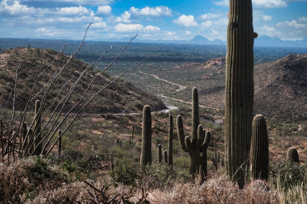
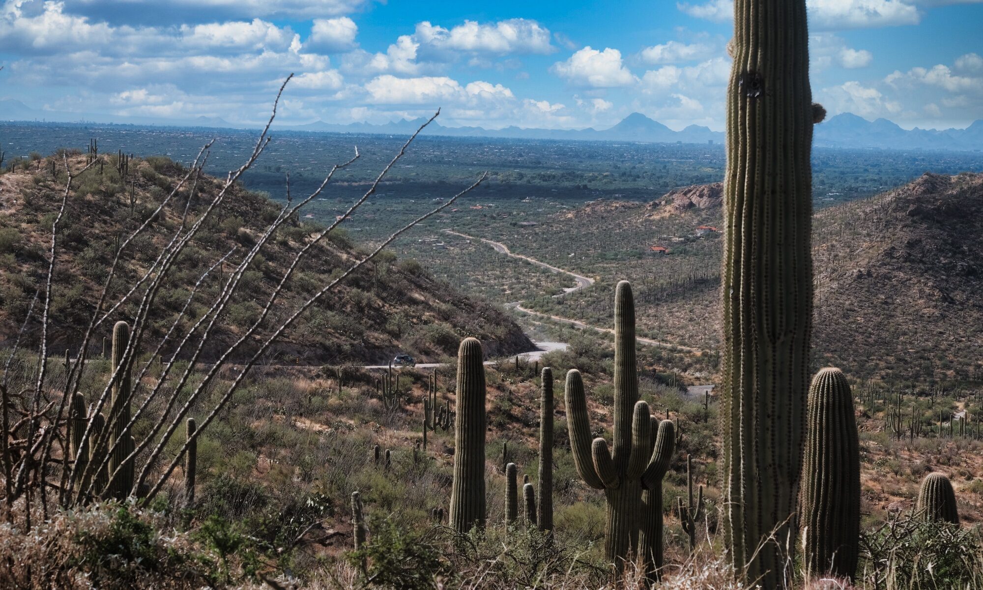
From here, you’ll get on the dirt roads leading up the back side of Mount Lemmon, including the Control Road which can be rocky and challenging in places. This rugged 25-mile dirt route starts in the high desert of Oracle and offers an intense, technical ascent for dual-sport and adventure riders. Expect everything from smooth gravel to rocky, rutted 4×4 sections and loose dirt switchbacks.
You’ll pass through Peppersauce Campground and climb through juniper grasslands into towering ponderosa pines.The final six miles are particularly steep and technical as you gain several thousand feet in elevation. As you reach the top, the road pops out near the Mount Lemmon Fire Station and the town of Summerhaven.
Mount Lemmon is home to Mount Lemmon Ski Valley, famously known as the southernmost ski destination in the continental United States. Perched near the 9,157-foot summit of the Santa Catalina Mountains, it offers a dramatic alpine escape just an hour’s drive from the desert heat of Tucson. ust below the resort, the town of Summerhaven offers a cozy retreat with mountain lodges, gift shops, and the famous Mount Lemmon Cookie Cabin.
There is nothing quite like the descent from Mount Lemmon down the Catalina Highway (also known as the Sky Island Scenic Byway). Starting from the alpine forests of Summerhaven at over 9,000 feet, you drop through six different ecosystems in just 27 miles, eventually returning to the giant saguaros of the Sonoran Desert floor. Be sure to stop at Windy Point Vista (milepost 14) for panoramic views of the Tucson valley and the surrounding rock formations. The asphalt is generally well-maintained, featuring sweeping curves and steep grades that provide an exhilarating ride for experienced motorcyclists.
Redington Road (Forest Road 371) is a rite of passage for Tucson-area adventure riders. This 30-mile trek over Redington Pass connects East Tanque Verde Road to the San Pedro River Valley near Cascabel and San Manuel, offering a raw, unpaved alternative to the manicured pavement of the Catalina Highway.
The road starts as a steep, winding paved climb that quickly turns to rough, washboarded dirt. You’ll rise through saguaro-studded foothills into high-desert grasslands with massive views of the Santa Catalina and Rincon Mountains. While the main road is often passable for high-clearance vehicles, motorcyclists should be prepared for deep ruts, sandy washes, and loose rocky switchbacks. Dropping down the eastern side toward the San Pedro Valley offers wide-open vistas and a more secluded, remote feel than the western slopes.
Once back on the Cascabel Road, where you were several hours ago, you’ll follow the same route south to Bisbee.
Details
- Location: Starts and ends at The Jonquil Motel in Bisbee, Arizona
- Distance: 312 mile loop
- Gas: Bisbee, Tombstone, Benson, Mammoth, Tucson, Benson, Tombstone
- Difficulty: Easy/Intermediate (Control Road)
- Road Surface: paved, gravel, dirt, rocky, hills
- Camping: Coronado National Forest
Approximate Mileage
- Start – Circle K Bisbee – 0 miles
- Mule Pass – 2 miles
- Start/End – Juniper Flats – 2 miles
- Gas – Tombstone – 24 miles
- Gas – Benson – 48 miles
- Cascabel Road – 52 miles
- Start dirt – 70 miles
- East End – Reddington Road – 91 miles
- End dirt – Gas – Mammoth – 115 miles
- Oracle, AZ – 127 miles
- Start dirt – Control Road – 130 miles
- End dirt – Summerhaven – 159 miles
- Catalina Highway (Sky Island Scenic Byway)
- Windy Point Vista
- Gas – Circle K Tucson – 191 miles
- Start dirt – Redington Road – 196 miles
- Cascabel Road – 221 miles
- End dirt
- Gas – Benson – 264 miles
- Gas – Tombstone – 287 miles
- End – Circle K Bisbee – 312 miles