This 148-mile adventure is one of the premier dual-sport rides in the Southwest, transitioning from Bisbee’s “haunted hills” to the vast, golden grasslands of the San Rafael Valley and ending in the lush birding haven of Patagonia.
Depart Bisbee via Highway 80 West. Head into the Coronado National Memorial and begin the ascent of Montezuma Pass. The final two miles are a steep, narrow dirt road with tight switchbacks that reward you with a 6,575-foot overlook of both the U.S. and Mexico.
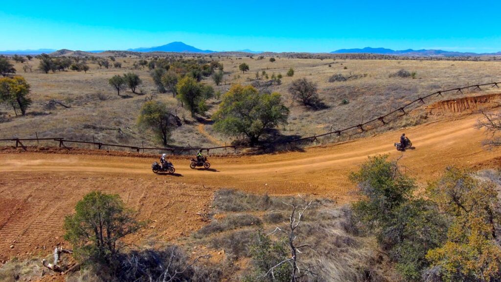
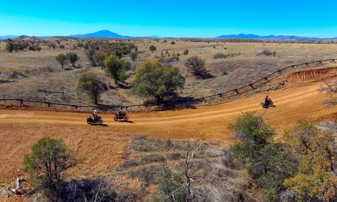
Descend the west side of the pass onto Forest Road 61, also known as the Border Road. This stretch runs parallel to the international border fence through the high-desert savannah. In 2026, the road remains a well-maintained but dusty two-track, though riders should watch for washboarded sections and loose gravel.
About 25 miles from the pass, you’ll reach the tiny, historic border outpost of Lochiel. This is the site where Fray Marcos de Niza reportedly first entered Arizona in 1539. It’s a quiet, remote spot perfect for a quick water break. From Lochiel, turn north toward the Patagonia Mountains. The terrain becomes more rugged and forested as you pass through the ghost towns of Duquesne and Harshaw. The final 10 miles into Patagonia on Harshaw Road transition from dirt back to winding pavement. Watch your speed as you enter town—the 15 MPH limit is strictly enforced.
This route is best suited for dual-sport or adventure bikes. Motorcycles will encounter sandy patches near Lochiel and rocky ruts in the Patagonia Mountains. Be alert on Harshaw Road for heavy equipment and trucks related to the Hermosa Project mine; riders are encouraged to give these vehicles right-of-way. There is no fuel or cell service between the Palominas area (near the start) and Patagonia. Carry at least 2–3 liters of water, as the high-elevation sun can be deceptively dehydrating. You will see a significant Border Patrol presence along FR 61. They are generally helpful; if you’re unsure of road conditions, it is common practice to ask an agent for a quick update.
Details
- Location: Starts and ends at The Jonquil Motel in Bisbee, Arizona
- Distance: 148 mile loop
- Gas, Food & Lodging: Bisbee, Palominas, Sonoita, Whetstone, Sierra Vista
- Difficulty: Easy
- Road Surface: paved, gravel
- Time: full-day
- Connects to: Border Coaster, Grasslands, Red Hill
Approximate Mileage
- Start – Circle K Bisbee – 0 miles
- Gas – Speedway Bisbee – 5 miles
- Gas – Chevron Bisbee – 5 miles
- Gas – Palominas – 19 miles
- Coronado Visitor Center – 28 miles
- Start dirt – 29 miles
- Montezuma Pass – 31 miles
- Montezuma Canyon Road – 31 miles
- Start – Border Coaster – 34 miles
- Start – Grasslands – 49 miles
- End – Border Coaster – 51 miles
- Lochiel, AZ – 57 miles
- Duquesne, AZ – 62 miles
- End – Grasslands – 67 miles
- Start – Red Hill – 68 miles
- Harshaw, AZ – 72 miles
- End dirt – 75 miles
- Patagonia, AZ – 80 miles
- Gathering Grounds Cafe – 80 miles
- Gas – Sonoita – 93 miles
- Gas – Whetstone – 112 miles
- Sierra Vista
- End – Circle K Bisbee – 148 miles