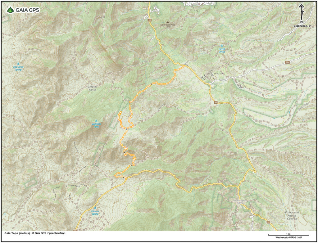
This road is a connector between the Duquesne Road and the Harshaw Road in Southern Arizona. It goes up a very steep hill to Guajalote Flats at the top.
This is a very short road with an extremely steep hill challenge. The hill approaches 24-degrees in places. You should make a decision as to whether you would be more comfortable going up or down this hill, or do it twice and go both ways.
There are several very tight switchbacks to navigate, some of them with very exposed drop-offs at the corners. The road surface is surprisingly good with minimal washouts, rock gardens or other challenges usually found on steep hills. In general it is fairly solid and smooth dirt with some embedded rocks.
If you like steep roads with lots of exposure this one is for you!
Guajalote Flats | Arizona
Details
- Distance: 7 miles
- Location: Arizona
- Start: Duquesne Road
- End: Harshaw Road
- Difficulty: Intermediate
- Conditions: dirt, embedded rocks, very steep hill
- Cities: Nogales, Arizona
Warning: Back-road travel can be hazardous. Road conditions can change quickly based on a variety of factors including the weather. Please respect road closures, the environment and the local population. Leave no trace, know your limits and carry plenty of water.